Wednesday, September 30, 2009

September 29 and 30, 2009 Mt. Rushmore, Norbeck Scenic Byway, Custer State Park

September 29, 2009

First thing this morning we went back up to Mt. Rushmore to get some pictures in more favorable light. Hope you like these better!


The Approach

Closer

One More Step

Through the Arch

The Monument

Of course there were interesting things not made of stone on the Monument grounds!

Mountain Goats!

Following our morning visit to Mt. Rushmore, we drove the Peter Norbeck Scenic Byway. See lots of details about the Byway here. Read more about Peter Norbeck here.

While there is a lot of beautiful and impressive scenery which we will get to in a minute, one of the fascinating aspects of the Byway is the use of "pigtail bridges" to traverse the steep mountainsides using a minimum of land to do it.

Click to enlarge, then read all about the bridges.

Here's a video of our ride under, around, and over a pigtail bridge and immediately into a tunnel.


Here's the view as we exited the tunnel (it did not come through in the video):

The white object at the end of the tree clearing is the four faces of the Mt. Rushmore Monument!

Another outstanding aspect of the Byway is the trip through the "Needles", the sharp rock peaks that crown the mountains here.

This formation is The Needles (sic) Eye.

Our timing was perfect. We got to see the sun pass through the Needles Eye!

Here's the tunnel we had to go through to get to the Needles Eye.

It is just about as small as it looks -- no large vehicles here!

Not all the Byway scenery is exciting. Some is just idyllic.......

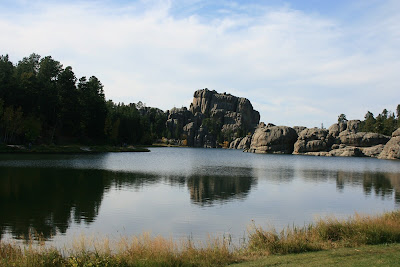
Sylvan Lake, Peter Norbeck Scenic Byway, Needles Road

The Byway led us to Custer State Park, where we found these friendly guys.

Part of a herd of Wild Burros in Custer State Park

And the Fall colors are coming on.

Someone has to be first!

Trees outline the stream in the valley.

And we did return to Mt. Rushmore for the nightly Lighting Ceremony. The dark and lights made it hard to get good pictures, but here are two that will give you the idea.

Through the State Flag Walk

While the Armed Services Veterans from the crowd participate in the flag lowering ceremony, the Monument comes to life.

So now you know why I was so tired last night!

September 30, 2009

Travel (only) day. US16 from Hill City to I-90 at Rapid City. East on I-90 to Sioux Falls, SD. 386 miles.

High wind all day. 25-30 mph with gusts to 40 mph. From the southeast, so we were driving into it all day. Kind of like driving an old car with very loose steering -- exciting sometimes! Took our fuel economy down from 7.5 mpg to 5.4 mpg!

Did get to stop at the big Cabela's in Mitchell, SD. Better, we managed to walk out without buying anything!

Sorry, but no pictures. Didn't see anything worth the effort. Increased our understanding of why South Dakotans are so enamored of the Black Hills -- quite a difference!

Our plan for tomorrow is in a state of flux. Tune it tomorrow to see what we do!

Love to you all,

MMG and DDG

Monday, September 28, 2009

September 28, 2009 Jewel Cave National Monument, Wind cave NP, Mt. Rushmore

ADDITION TO September 26, 2009

Headline: Turkeys tie up traffic on I-90! And this time we're not talking about Prius drivers going 55 in the fast lane!

These turkeys were parading right across the Interstate as we approached from the West. The line stretched almost all the way across 4 lanes and the median. Both Westbound lanes had already stopped to let them pass and, of course we did, too. It took us a minute to get the camera out and going so we only got the last 13 or so........

Turkey Trot on I-90


On to today!

A busy day! This morning we went on a tour of The Jewel Cave National Monument -- underground! The cave is the second longest known in the U.S. The longest is Mammoth Cave NP in Kentucky at 367 miles!

It is impossible to get pictures of what we saw that show the size and depth of the formations, so let's just enjoy the formations and the colors and let our imaginations run with what we see.

Invasion of the Slime Monsters

Ulcer?

Outer Space Wormhole

Your Guess ?

See the fish ?

Deep Space

Jellyfish

Gold!

Coral Reef

Colors

Stone Lily

Creature from the Black Lagoon Reaching for You!

More Colors

I think the most amazing thing to us is the fluidity of the formations and the colors that spring to life under the flash.

We had our daily picnic under a tree at the Monument then cruised on over t0 the Wind Cave National Park. We arrived too late for one tour and way too early for the next, so decided to drive around the Park while working our way back toward Mt. Rushmore.

The geography of Wind Cave NP is much like the Yellowstone valleys with flatlands and gentle hills. A big difference is that the pasturelands at Wind Cave are populated with thousands of Black-tailed Prairie Dogs and many Pronghorns -- and, yes, a few Bison.

We passed on pictures of the prairie Dogs and the Bison, but the Pronghorns were so close and the male had such a good rack that we couldn't resist!

A First! All Faces!

The Patriarch Herding His Harem

Patriarch I

Patriarch II


Then it was on the Mt. Rushmore.

Guess Who, Guess Where.

Through the Arch

We hope/plan to go back tomorrow to get some pictures with more favorable light. Also to return tomorrow evening to see the Lighting Ceremony. During the day we will take a couple of the scenic drives in Custer State Park.

More then!

Love to you all,

MMG and DDG

Sunday, September 27, 2009

September 27, 2009 Trip to Rapid City

What a day! A cold front came through and the 60 degree temperature we woke up to was the high for the day. It only dropped into the low 50s, but the high winds made it pretty miserable.

We decided it would be a good day to do the laundry and go to Rapid City for some needed shopping. Our plan to go to visit a couple of the caves in the area today fell to the assumption that all the weekenders up here would decide to do the same thing to get out of the wind.

So we did laundry all morning (it had been a long time since we did laundry), then headed to the Big City for lunch and an afternoon of Target, WalMart, a Mall, and Cabela's.

The high point of the trip was the site of this herd of Big Horn Sheep that was helping with the lawn maintenance at a house just on the outskirts of Rapid City. So much for all the time we spend in the "wildlife viewing areas"!


And to wrap it up, a new record for the Pelicanlady World Famous Collection of Wildlife Butts -- the Whole Herd!


Cave visits, more scenic tours, and maybe Mt Rushmore tomorrow.

Love to you all.

MMG and DDG

Saturday, September 26, 2009

September 26, 2009 The Black Hills, Spearfish Canyon Scenic Byway, Devils Tower

Sightseeing day! Our main objective was to visit Devils Tower, but imagine our surprise when we found that the most direct route to Devils Tour, US385, would run right up the middle of the Black Hills, including a portion of the Black Hills National Forest, and that US385 would connect directly with Spearfish Canyon Scenic Byway!

What we had read about the Black Hills indicated that they included the highest peaks east of the Rockies in the U.S. May be, but we didn't see them. In fact, the scenery was more akin to a ride through the NC mountains, pretty, but not impressive, so we were a little down to start the day.

Things improved as we reached the end of US385 and turned toward the scenic byway. We were smack in the middle of Deadwood, SD (and every kid of my generation knows that Deadwood was a "Wild West" town where Wild Bill Hickok was killed) which (the entire town) is on the National Historic District list! It was interesting to see the town now.

Leaving Deadwood, we immediately found ourselves in Lead (pronounced "Leed") locally world famous as the site of the Homestake Mine, a gold mine, discovered in 1876 and continuously operated for over 125 years, producing over a $1 Billion in gold.

Not only did the Homestake have over 200 miles of underground tunnels, it also operated an open pit mine practically in right in town. The mine is 1200 feet deep and 1/2 mile wide!

The Open Cut Mine, a gold pit mine, Lead, SD. Beautiful striations in the rock, no?

While we were checking out the offerings around the Lead visitor center, we were surrounded by flying insects resembling locusts, which I hadn't seen in any number since my days growing up on the family farm. They seem to come in three renditions, or perhaps stages of development. Here they are:

Locust 1

Locust 2

Locusts 3 and 4

Then it was on to Spearfish Canyon. We had been told by a young couple we met in Glacier NP that this scenic drive was a "must do" if we were in the area, especially to see Bridal Veil Falls.

It was with visions of the famous Bridal Veil Fall in Yosemite NP that we set out. After seeing the shallow depth of the canyon, here:

Spearfish Canyon

We weren't really expecting this:

Artist's rendition of Bridal Veil Falls in Yosemite NP

But maybe this:
Bridal Veil -- the real thing in Spring

Or even this:
Bridal Veil -- the real thing in Fall

But for sure not this!

Bridal Veil Falls, Spearfish Canyon, SD


We can't decide if that young couple, who live in SD, are really impressed with "their" Bridal Veil Falls -- it is pretty unique for this area -- or if they are still chuckling about how they sucked in the old folks.......

So, off to Devils Tower. Finally a place lives up to our expectations! As we approach:

Devils Tower from several miles away.

Facts about Devils Tower.

Up close shot from the visitor center.

Another angle.

View from the trail around the base of the Tower.

And as we left the monument, we passed through the Black-tailed prairie Dog village these dudes posed for us.

Dude 1

Dude 2


And here's your flower for today!

Spearfish Canyon Flower.

Tomorrow, maybe some cave exploring and maybe a trip to town!

Love to all,

MMG and DDG